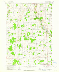
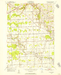
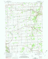
1961 Map of Brockway
USGS Topo · Published 1963This historical map portrays the area of Brockway in 1961, primarily covering St. Clair County. Featuring a scale of 1:24000, this map provides a highly detailed snapshot of the terrain, roads, buildings, counties, and historical landmarks in the Brockway region at the time. Published in 1963, it is one of 2 known editions of this map due to revisions or reprints.
Find a feature on this map
46 named features on this map. Tap any name to fly to it.
Don’t see what you’re looking for? This feature index may not catch every label — zoom into the map to look around manually.
Map Details
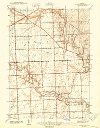
Editions of this 1961 Brockway Map
2 editions found
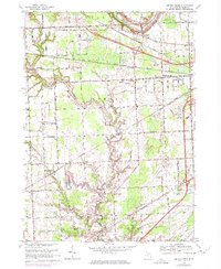
Historical Maps of Emmett Through Time
29 maps found

1928 Hicky
St. Clair County, MI

1936 Rattle Run
St. Clair County, MI

1939 Adair
St. Clair County, MI

1939 Goodells
St. Clair County, MI

1939 Smiths Creek
St. Clair County, MI

1939 St. Clair Flats
St. Clair County, MI
1942 Rattle Run
St. Clair County, MI

1945 Allenton
St. Clair County, MI
1949 St. Clair Flats
St. Clair County, MI

1952 Adair
St. Clair County, MI

1952 Allenton
St. Clair County, MI
1952 Goodells
St. Clair County, MI
1952 Rattle Run
St. Clair County, MI

1952 Smiths Creek
St. Clair County, MI

1952 St. Clair Flats
St. Clair County, MI
1961 Avoca
St. Clair County, MI
1961 Brockway
St. Clair County, MI
1968 Adair
St. Clair County, MI

1968 Allenton
St. Clair County, MI
1968 Goodells
St. Clair County, MI

1968 Rattle Run
St. Clair County, MI
1968 Smiths Creek
St. Clair County, MI
1968 St. Clair Flats
St. Clair County, MI

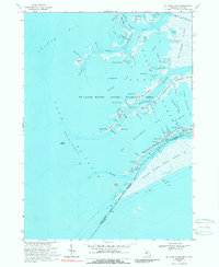
1981 Lake St. Clair North
St. Clair County, MI

1991 Adair
St. Clair County, MI

1991 Allenton
St. Clair County, MI

1991 Goodells
St. Clair County, MI

1991 Rattle Run
St. Clair County, MI

1991 Smiths Creek
St. Clair County, MI