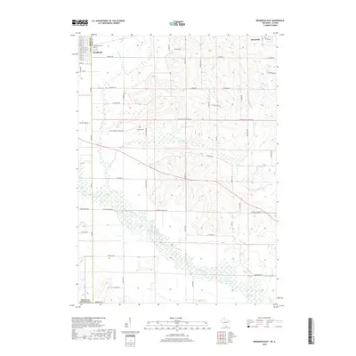
2018 Map of Brodhead East
USGS Topo · Published 2018About this map
Sugar River meanders across the southern landscape of this 2018 survey, defining a drainage basin that includes Taylor Creek and Willow Creek. The terrain is characterized by a sophisticated grid of rural roads, including W Beloit Newark Rd and Co RD T, which partition the agricultural lands between the settlements of Brodhead in the northwest and Orfordville in the northeast. This modern topographic study reveals the enduring placement of community landmarks like Greenwood Cemetery, while also documenting smaller rural sites such as Northrup Cemetery situated off W Avon North Townline Rd. The map illustrates the convergence of local drainage systems like Swan Creek into the primary river valley, offering a precise look at the hydrology and parcel divisions at the border of Green and Rock Counties.
Find a feature on this map
60 named features on this map. Tap any name to fly to it.
Don’t see what you’re looking for? This feature index may not catch every label — zoom into the map to look around manually.
Map Details
Editions of this 2018 Brodhead East Map
This is the sole edition of this map. No revisions or reprints were ever made.
Other maps of this area

1891 · Janesville
USGS Topo · 1:62,500

1893 · Janesville
USGS Topo · 1:62,500

1893 · Brodhead
USGS Topo · 1:62,500

1918 · Rockford
USGS Topo · 1:62,500

1932 · Pecatonica
USGS Topo · 1:62,500

1936 · Pecatonica
USGS Topo · 1:62,500

1938 · Rockford
USGS Topo · 1:62,500

1954 · Rockford
USGS Topo · 1:250,000

1955 · Rockford
USGS Topo · 1:250,000

1958 · Rockford
USGS Topo · 1:250,000