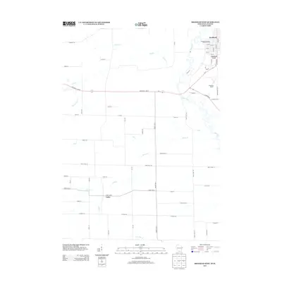
2013 Map of Brodhead West
USGS Topo · Published 2013About this map
The Sugar River meanders through the landscape of southern Green County, defining the eastern edge of this agricultural region near the Illinois border. The settlement of Brodhead anchors the northeast corner, where a grid of streets including 14th St and W 5th Ave transitions into rural residential areas like Cardinal Crest. The map reveals a sophisticated network of waterways feeding into the main river, such as Juda Br, Sylvester Cr, and Riley School Br, reflecting the drainage patterns essential to the local dairy farming economy. Rural life is further evidenced by the unincorporated community of Oakley to the south and the presence of the Brodhead Airport. Major transportation routes like State Road 11 and 81 and County Hwy-G intersect the township, connecting disparate farmsteads and rural homes along roads like Shanghai Rd and Town Center Rd.
Find a feature on this map
57 named features on this map. Tap any name to fly to it.
Don’t see what you’re looking for? This feature index may not catch every label — zoom into the map to look around manually.
Map Details
Editions of this 2013 Brodhead West Map
This is the sole edition of this map. No revisions or reprints were ever made.
Other maps of this area

1893 · Brodhead
USGS Topo · 1:62,500

1920 · Monroe
USGS Topo · 1:62,500

1922 · Monroe
USGS Topo · 1:62,500

1932 · Pecatonica
USGS Topo · 1:62,500

1936 · Pecatonica
USGS Topo · 1:62,500

1939 · Freeport
USGS Topo · 1:48,000

1944 · Freeport
USGS Topo · 1:62,500

1954 · Rockford
USGS Topo · 1:250,000

1955 · Rockford
USGS Topo · 1:250,000

1958 · Rockford
USGS Topo · 1:250,000