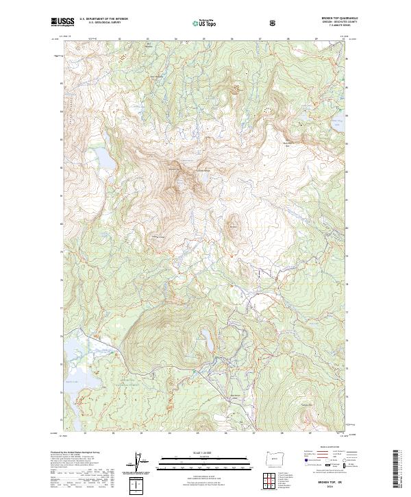
2024 Map of Broken Top
USGS Topo · Published 2024About this map
Broken Top and the Bend Glacier anchor this high-elevation landscape within the Three Sisters Wilderness. This 2024 survey captures a terrain defined by volcanic features and glacial activity, including the prominent Crook Glacier and the distinct volcanic bowl of Cayuse Crater. The map reveals an intricate network of waterways such as Soda Creek and North Fork Tumalo Creek that drain these peaks into alpine basins like Todd Lake and Sparks Lake.
Find a feature on this map
84 named features on this map. Tap any name to fly to it.
Don’t see what you’re looking for? This feature index may not catch every label — zoom into the map to look around manually.
Map Details
Editions of this 2024 Broken Top Map
This is the sole edition of this map. No revisions or reprints were ever made.
Other maps of this area

1929 · Three Sisters
USGS Topo · 1:125,000

1930 · Maiden Peak
USGS Topo · 1:125,000

1932 · Three Sisters
USGS Topo · 1:125,000

1934 · Maiden Peak
USGS Topo · 1:125,000

1955 · Crescent
USGS Topo · 1:250,000

1955 · Bend
USGS Topo · 1:250,000

1957 · Crescent
USGS Topo · 1:250,000

1957 · Bend
USGS Topo · 1:250,000

1958 · Crescent
USGS Topo · 1:250,000

1958 · Bend
USGS Topo · 1:250,000