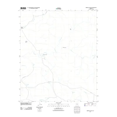
2011 Map of Bronco Gulch
USGS Topo · Published 2011About this map
Rocky Junction and the namesake Bronco Gulch characterize this high-desert landscape in eastern Arizona. The terrain is defined by a series of drainages and seasonal water sources, including the San Carlos River, Natanes Creek, and Ash Creek. This 2011 survey documents a network of tribal infrastructure, most notably Indian Rte 7, Indian Rte 5, and Indian Rte 8, which provide access to the area's numerous watering points such as Summit Tank and Red Rock Tank. Local topographical features like Warm Springs Flat, Kidde Canyon, and Allen Trap reveal the complex geography utilized by ranchers and local residents. The map illustrates a high reliance on specific water management sites, evidenced by the distribution of various named tanks across the dry hillsides.
Find a feature on this map
24 named features on this map. Tap any name to fly to it.
Don’t see what you’re looking for? This feature index may not catch every label — zoom into the map to look around manually.
Map Details
Editions of this 2011 Bronco Gulch Map
This is the sole edition of this map. No revisions or reprints were ever made.
Other maps of this area

1954 · Mesa
USGS Topo · 1:250,000

1957 · Mesa
USGS Topo · 1:250,000

1958 · Mesa
USGS Topo · 1:250,000

1960 · Mesa
USGS Topo · 1:250,000

1964 · Mesa
USGS Topo · 1:250,000

1965 · Sontag Mesa
USGS Topo · 1:24,000

1966 · Branaman Spring
USGS Topo · 1:24,000
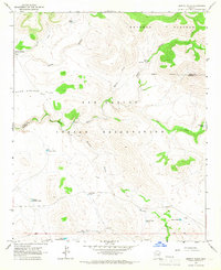
1966 · Bronco Gulch
USGS Topo · 1:24,000

1966 · Georges Butte
USGS Topo · 1:24,000
1966 · Ash Creek Ranch
USGS Topo · 1:24,000