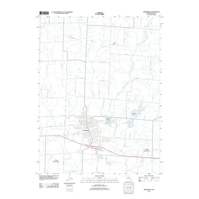
2012 Map of Brookfield
USGS Topo · Published 2012About this map
Brookfield serves as the central hub of this Linn County landscape, where the confluence of several waterways shaped the local topography. The town is flanked by Elk Creek to the west and the wandering course of Long Branch to the north, which flows toward the Brookfield Reservoir Dam. This 2012 survey illustrates the transition from a traditional rail-town layout to one supported by modern infrastructure, including the General John J Pershing Memorial Airport and the North Central Missouri Regional Airport to the southeast. Local history is anchored by sites such as Rosehill Cemetery and the 4-H Fairgrounds, reflecting the region's agricultural roots. Away from the primary settlement, the landscape is defined by rural road networks like Getty Dr and Icon Rd, and water features including West Yellow Creek and Brookfield Country Club Lake.
Find a feature on this map
71 named features on this map. Tap any name to fly to it.
Don’t see what you’re looking for? This feature index may not catch every label — zoom into the map to look around manually.
Map Details
Editions of this 2012 Brookfield Map
This is the sole edition of this map. No revisions or reprints were ever made.
Other maps of this area

1946 · Brookfield
USGS Topo · 1:62,500

1948 · Brookfield
USGS Topo · 1:62,500

1949 · Sumner
USGS Topo · 1:24,000

1949 · Rothville
USGS Topo · 1:24,000

1949 · Bucklin
USGS Topo · 1:24,000

1949 · Bucklin NW
USGS Topo · 1:24,000

1950 · Bucklin
USGS Topo · 1:24,000

1950 · Sumner
USGS Topo · 1:24,000

1950 · Rothville
USGS Topo · 1:24,000

1950 · Bucklin NW
USGS Topo · 1:24,000