
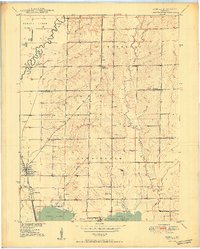
1950 Map of Sumner
USGS Topo · Published 1950About this map
Sumner serves as the primary rail hub in this Chariton County landscape, situated at the junction of the Wabash and Chicago Burlington and Quincy railroads. The town's grid is clearly defined, flanked by Purvis Cem and Lakeside Cemetery. To the north, the small settlement of Forker Boomer PO provides a window into the rural post office network of the mid-20th century.
Find a feature on this map
32 named features on this map. Tap any name to fly to it.
Don’t see what you’re looking for? This feature index may not catch every label — zoom into the map to look around manually.
Map Details
Editions of this 1950 Sumner Map
2 editions found
Other maps of this area

1924 · Chula
USGS Topo · 1:62,500

1924 · Hale
USGS Topo · 1:62,500

1946 · Brookfield
USGS Topo · 1:62,500

1947 · Chula
USGS Topo · 1:62,500

1948 · Brookfield
USGS Topo · 1:62,500

1949 · Mendon
USGS Topo · 1:24,000

1949 · Indian Grove
USGS Topo · 1:24,000

1949 · Sumner
USGS Topo · 1:24,000

1949 · Rothville
USGS Topo · 1:24,000

1950 · Rothville
USGS Topo · 1:24,000