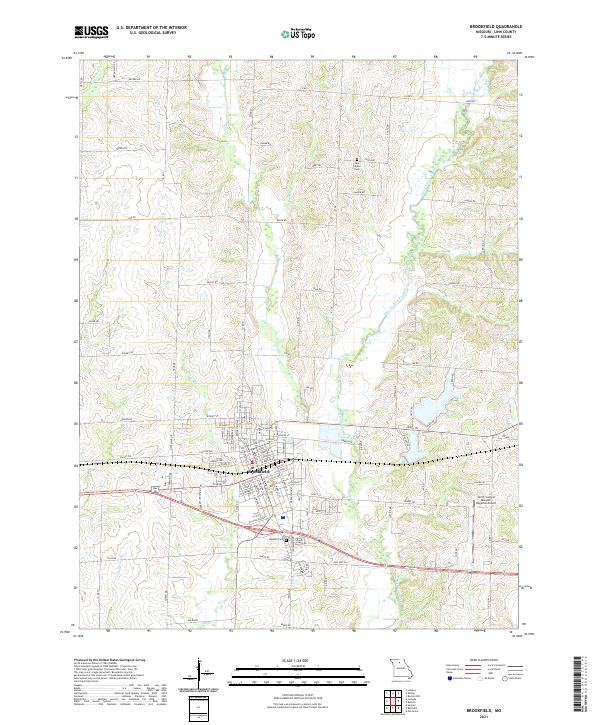
2021 Map of Brookfield
USGS Topo · Published 2021About this map
The city of Brookfield serves as the central hub of this Linn County landscape, characterized by a detailed street grid including W Pratt St, Laclede Ave, and E John St. The town's layout reflects its history as a regional center, now anchored to the east by the North Central Missouri Regional Airport. The surrounding rural sections are defined by a complex drainage network, with West Yellow Creek and its many tributaries like Long Br and Spring Br cutting through the terrain. These waterways shaped the placement of early infrastructure and family-named roads such as Hagar Rd and Jansen Rd. For those researching local history, the map precisely locates several interment sites, including New Garden Cem to the north and the large Rosehill Cem situated on the southern edge of the settlement.
Find a feature on this map
65 named features on this map. Tap any name to fly to it.
Don’t see what you’re looking for? This feature index may not catch every label — zoom into the map to look around manually.
Map Details
Editions of this 2021 Brookfield Map
This is the sole edition of this map. No revisions or reprints were ever made.
Other maps of this area

1946 · Brookfield
USGS Topo · 1:62,500

1948 · Brookfield
USGS Topo · 1:62,500

1949 · Sumner
USGS Topo · 1:24,000

1949 · Rothville
USGS Topo · 1:24,000

1949 · Bucklin
USGS Topo · 1:24,000

1949 · Bucklin NW
USGS Topo · 1:24,000

1950 · Bucklin
USGS Topo · 1:24,000

1950 · Sumner
USGS Topo · 1:24,000

1950 · Rothville
USGS Topo · 1:24,000

1950 · Bucklin NW
USGS Topo · 1:24,000