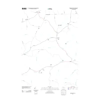
2013 Map of Brookland
USGS Topo · Published 2013About this map
Denton Hill State Park and the Denton Hill Ski Area anchor the southern portion of this Potter County landscape, where the high ridges of the Allegheny Plateau give way to numerous carved drainages. The settlement of Brookland serves as a central point along Pine Cr, while the crossroads of Gold and Raymond occupy the northern reaches. This terrain is defined by its "hollows," such as Mill Hollow, Heath Hollow, and Elm Hollow, which often bear the names of early settling families. The geography here is significant for its hydrologic divides, specifically the Triple Divide, which marks a point where water flows toward three different major drainage basins. Transportation follows the winding creek beds and narrow valleys, with Walton and Newfield Junction marking key points along the historic travel corridors that connect these upland communities.
Find a feature on this map
60 named features on this map. Tap any name to fly to it.
Don’t see what you’re looking for? This feature index may not catch every label — zoom into the map to look around manually.
Map Details
Editions of this 2013 Brookland Map
This is the sole edition of this map. No revisions or reprints were ever made.
Other maps of this area

1899 · Gaines
USGS Topo · 1:62,500

1900 · Gaines
USGS Topo · 1:62,500

1932 · Genesee
USGS Topo · 1:62,500

1937 · Genesee
USGS Topo · 1:62,500

1947 · Conrad
USGS Topo · 1:62,500

1947 · Galeton
USGS Topo · 1:62,500

1947 · Ayers Hill
USGS Topo · 1:24,000

1947 · Cherry Springs
USGS Topo · 1:24,000

1947 · Galeton
USGS Topo · 1:24,000
1949 · Ayers Hill
USGS Topo · 1:24,000
Featured Places
- Sweden Township, PA
- Allegany Township, PA
- Raymond, Allegany Township
- Walton, Ulysses Township
- Newfield Junction, Ulysses Township