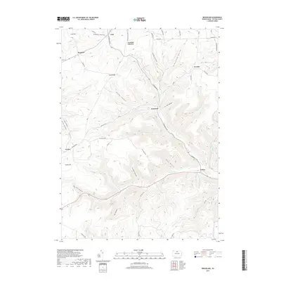
2019 Map of Brookland
USGS Topo · Published 2019About this map
Pine Cr flows through the central valley of this Potter County landscape, anchoring a network of narrow hollows and high summits. This 2019 survey documents the enduring rural character of the region, where the Triple Divide stands as a significant hydrological marker between major drainage basins. Small settlements such as Gold, Newfield Junction, and Brookland follow the winding path of the creek and its associated roads, including N Brookland Rd and S Brookland Rd. The topography is defined by deeply incised valleys like Reese Hollow and Heath Hollow, which separate high points like Cobb Hill and Fox Hill. The map also captures the path of Ninemile Run to the south, highlighting the complex water system that has long dictated the placement of homesteads and local infrastructure in this part of northern Pennsylvania.
Find a feature on this map
52 named features on this map. Tap any name to fly to it.
Don’t see what you’re looking for? This feature index may not catch every label — zoom into the map to look around manually.
Map Details
Editions of this 2019 Brookland Map
This is the sole edition of this map. No revisions or reprints were ever made.
Other maps of this area

1899 · Gaines
USGS Topo · 1:62,500

1900 · Gaines
USGS Topo · 1:62,500

1932 · Genesee
USGS Topo · 1:62,500

1937 · Genesee
USGS Topo · 1:62,500

1947 · Conrad
USGS Topo · 1:62,500

1947 · Galeton
USGS Topo · 1:62,500

1947 · Ayers Hill
USGS Topo · 1:24,000

1947 · Cherry Springs
USGS Topo · 1:24,000

1947 · Galeton
USGS Topo · 1:24,000
1949 · Ayers Hill
USGS Topo · 1:24,000
Featured Places
- Sweden Township, PA
- Allegany Township, PA
- Raymond, Allegany Township
- Walton, Ulysses Township
- Newfield Junction, Ulysses Township