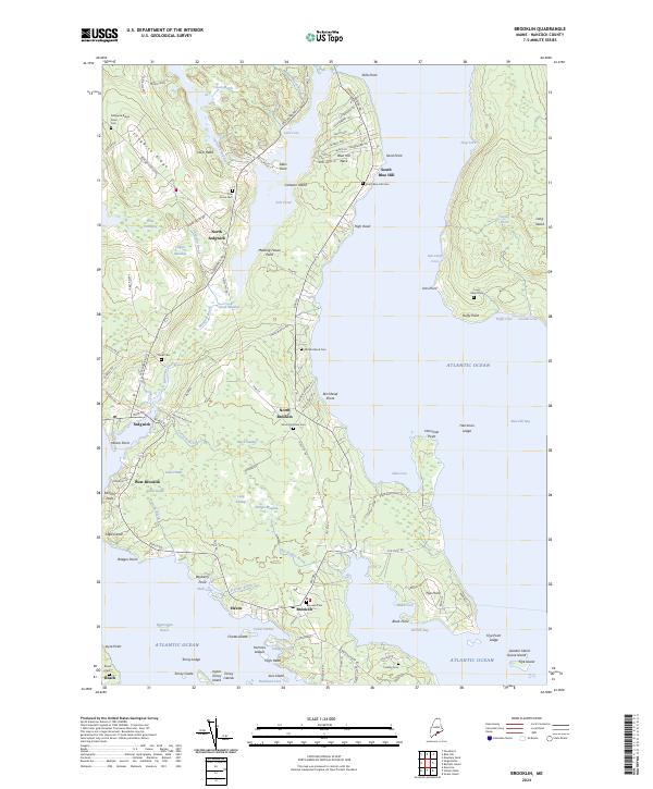
2024 Map of Brooklin
USGS Topo · Published 2024About this map
Brooklin and Sedgwick anchor this coastal landscape in Hancock County, Maine, where the irregular shoreline of Blue Hill Bay and the Reach creates a complex network of points and coves. The map reveals a high concentration of burial sites, including the Mount Ephraim Cem and the Old Birchland Cem, which speak to the long-established maritime and farming communities on this peninsula. Settlements like Haven and North Brooklin are connected by local routes such as Bay Rd and Hales Hill Rd, skirting significant wetlands like the Great Heath and Black Swamp. Offshore, the survey details numerous landforms including Carleton Island, Chatto Island, and Upper Torrey Island, illustrating the jagged nature of the Maine coast and the proximity of these islands to the mainland centers of commerce and life.
Find a feature on this map
134 named features on this map. Tap any name to fly to it.
Don’t see what you’re looking for? This feature index may not catch every label — zoom into the map to look around manually.
Map Details
Editions of this 2024 Brooklin Map
This is the sole edition of this map. No revisions or reprints were ever made.
Other maps of this area

1904 · Deer Isle
USGS Topo · 1:62,500

1904 · Mount Desert
USGS Topo · 1:62,500

1904 · Swan Island
USGS Topo · 1:62,500

1904 · Bluehill
USGS Topo · 1:62,500

1905 · Penobscot Bay
USGS Topo · 1:125,000

1942 · Mount Desert
USGS Topo · 1:62,500

1942 · Deer Isle
USGS Topo · 1:62,500

1943 · Swans Island
USGS Topo · 1:62,500

1944 · Blue Hill
USGS Topo · 1:62,500

1944 · Deer Isle
USGS Topo · 1:62,500