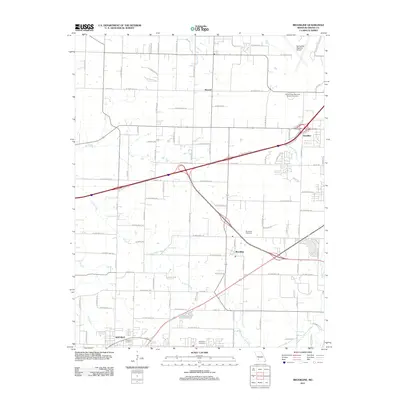
2011 Map of Brookline
USGS Topo · Published 2011About this map
Brookline and the northern edge of Republic anchor this landscape just southwest of Springfield during the early 2010s. The map illustrates a transitional geography where traditional Greene County farm roads meet modern infrastructure developments. Significant family history sites are distributed throughout the area, including Evergreen Cemetery near the southern boundary and Brookline Cemetery further north. The transportation network is defined by major highway corridors that bisect the rural grid, passing near the settlement of Haseltine and the Deer Lake Golf Crse.
Find a feature on this map
78 named features on this map. Tap any name to fly to it.
Don’t see what you’re looking for? This feature index may not catch every label — zoom into the map to look around manually.
Map Details
Editions of this 2011 Brookline Map
This is the sole edition of this map. No revisions or reprints were ever made.
Other maps of this area

1884 · Springfield
USGS Topo · 1:125,000

1886 · Greenfield
USGS Topo · 1:125,000

1886 · Springfield
USGS Topo · 1:125,000

1888 · Greenfield
USGS Topo · 1:125,000

1919 · Halltown
USGS Topo · 1:62,500

1935 · Springfield
USGS Topo · 1:24,000

1936 · Brookline
USGS Topo · 1:24,000

1948 · Willard
USGS Topo · 1:24,000

1948 · Ebenezer
USGS Topo · 1:24,000

1954 · Springfield
USGS Topo · 1:250,000