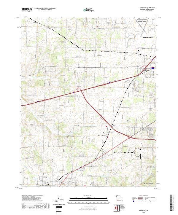
2021 Map of Brookline
USGS Topo · Published 2021About this map
Brookline and Republic anchor this landscape southwest of Springfield, where suburban growth meets the agricultural heritage of Greene County. The area is defined by its complex drainage network, featuring the Sac River in the northwest and Wilsons Creek in the southeast, with local landmarks like Dailey Spring and McElhaney Branch carving through the terrain. The transition from rural homesteads to modern infrastructure is visible in the proximity of Springfield-Branson National Airport to older community sites. Genealogists and local historians can trace several burial grounds across the quadrangle, including Brookline Cemetery, Evergreen Cemetery, and Harrington Cemetery. Smaller settlements such as Elwood and Haseltine remain distinct points along the road and rail corridors that connect these growing Ozark communities.
Find a feature on this map
63 named features on this map. Tap any name to fly to it.
Don’t see what you’re looking for? This feature index may not catch every label — zoom into the map to look around manually.
Map Details
Editions of this 2021 Brookline Map
This is the sole edition of this map. No revisions or reprints were ever made.
Other maps of this area

1884 · Springfield
USGS Topo · 1:125,000

1886 · Greenfield
USGS Topo · 1:125,000

1886 · Springfield
USGS Topo · 1:125,000

1888 · Greenfield
USGS Topo · 1:125,000

1919 · Halltown
USGS Topo · 1:62,500

1935 · Springfield
USGS Topo · 1:24,000

1936 · Brookline
USGS Topo · 1:24,000

1948 · Willard
USGS Topo · 1:24,000

1948 · Ebenezer
USGS Topo · 1:24,000

1954 · Springfield
USGS Topo · 1:250,000