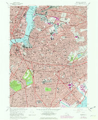
1967 Map of Brooklyn
USGS Topo · Published 1979About this map
Greenwood Cemetery and the Cemetery of the Holy Cross anchor the southern landscape of this dense urban survey, illustrating the significant land use dedicated to memorial grounds in central Kings County. The map reveals a post-war industrial and maritime powerhouse along the East River, where the Navy Yard Basin and Wallabout Bay contrast with the sleek, rising profile of Manhattan landmarks like the Empire State Building and United Nations Headquarters.
Find a feature on this map
173 named features on this map. Tap any name to fly to it.
Don’t see what you’re looking for? This feature index may not catch every label — zoom into the map to look around manually.
Map Details
Editions of this 1967 Brooklyn Map
4 editions found
Other maps of this area

1888 · Paterson
USGS Topo · 1:62,500

1889 · Brooklyn
USGS Topo · 1:62,500

1891 · Brooklyn
USGS Topo · 1:62,500

1891 · Harlem
USGS Topo · 1:62,500

1892 · Paterson
USGS Topo · 1:62,500

1897 · Harlem
USGS Topo · 1:62,500

1897 · Brooklyn
USGS Topo · 1:62,500

1898 · Harlem
USGS Topo · 1:62,500

1898 · Staten Island
USGS Topo · 1:62,500

1898 · Brooklyn
USGS Topo · 1:62,500