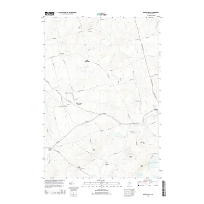
2014 Map of Brooks West
USGS Topo · Published 2014About this map
East Thorndike and Brooks anchor this Waldo County landscape, where the rural crossroads of Walker Corner and Knox Ledge Corner highlight the historical settlement patterns of the Maine interior. The map reveals a dense network of local burial grounds, including Cole Cem, Wing Cem, and the Knox Station Cem, which provide essential points of reference for genealogical research. The topography is defined by prominent elevations such as Hedgehog Hill and Skyscraper Hill, which overlook a complex drainage system fed by Marsh Stream and Stantial Brook. In the southeastern corner, the headwaters of Lake Passagassawakeag and Ellis Pond suggest the transition toward the coastal watershed. The preservation of local road names like Moosehead Trail Hwy and Purple Heart Hwy reflects the evolution of transit through these upland townships.
Find a feature on this map
78 named features on this map. Tap any name to fly to it.
Don’t see what you’re looking for? This feature index may not catch every label — zoom into the map to look around manually.
Map Details
Editions of this 2014 Brooks West Map
This is the sole edition of this map. No revisions or reprints were ever made.
Other maps of this area

1915 · Belfast
USGS Topo · 1:62,500

1916 · Liberty
USGS Topo · 1:62,500

1917 · Belfast
USGS Topo · 1:62,500

1926 · Burnham
USGS Topo · 1:62,500

1932 · Brooks
USGS Topo · 1:62,500

1941 · Belfast
USGS Topo · 1:62,500

1942 · Liberty
USGS Topo · 1:62,500

1948 · Bangor
USGS Topo · 1:250,000

1950 · Belfast
USGS Topo · 1:50,000

1950 · Liberty
USGS Topo · 1:50,000