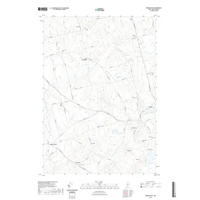
2021 Map of Brooks West
USGS Topo · Published 2021About this map
East Thorndike and Knox Center anchor this landscape in Waldo County, where the terrain is defined by a dense concentration of small family and community cemeteries. The geography reflects a legacy of dispersed rural settlement, with names like Jackson Corner Cem, Cole Cem, and Knox Station Cem dotting the hillsides and crossroads. Water drainage patterns are complex, featuring the prominent Stantial Bog and its outflow, Stantial Brook, alongside several other waterways such as Wing Brook and Great Farm Brook. Elevations rise toward the southeast near Skyscraper Hill and Hedgehog Hill, while the village of Brooks sits along Marsh Stream. This detailed 2021 update from the U.S. Geological Survey preserves the locations of these historical burial grounds and early township centers amidst the modern road network.
Find a feature on this map
70 named features on this map. Tap any name to fly to it.
Don’t see what you’re looking for? This feature index may not catch every label — zoom into the map to look around manually.
Map Details
Editions of this 2021 Brooks West Map
This is the sole edition of this map. No revisions or reprints were ever made.
Other maps of this area

1915 · Belfast
USGS Topo · 1:62,500

1916 · Liberty
USGS Topo · 1:62,500

1917 · Belfast
USGS Topo · 1:62,500

1926 · Burnham
USGS Topo · 1:62,500

1932 · Brooks
USGS Topo · 1:62,500

1941 · Belfast
USGS Topo · 1:62,500

1942 · Liberty
USGS Topo · 1:62,500

1948 · Bangor
USGS Topo · 1:250,000

1950 · Belfast
USGS Topo · 1:50,000

1950 · Liberty
USGS Topo · 1:50,000