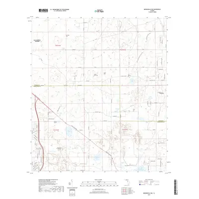
2018 Map of Brooksville NW
USGS Topo · Published 2018About this map
Annutteliga Hammock and the surrounding karst terrain of the Florida National Scenic Trail dominate this landscape on the border of Hernando and Citrus counties. The geography is defined by a high concentration of sinkholes and ponds, including Lizzie Hart Sink, Brush Sink, and Stage Pond. These natural depressions create a complex drainage pattern throughout the lowlands of Turkey Prairie and Habb Prairie.
Find a feature on this map
102 named features on this map. Tap any name to fly to it.
Don’t see what you’re looking for? This feature index may not catch every label — zoom into the map to look around manually.
Map Details
Editions of this 2018 Brooksville NW Map
This is the sole edition of this map. No revisions or reprints were ever made.
Other maps of this area

1895 · Tsala Apopka
USGS Topo · 1:62,500

1954 · Lecanto
USGS Topo · 1:24,000

1954 · Homosassa
USGS Topo · 1:24,000

1954 · Brooksville NW
USGS Topo · 1:24,000

1954 · Nobleton
USGS Topo · 1:24,000

1954 · Brooksville
USGS Topo · 1:24,000

1954 · Chassahowitzka
USGS Topo · 1:24,000

1954 · Inverness
USGS Topo · 1:24,000

1954 · Brooksville SE
USGS Topo · 1:24,000

1954 · Weekiwachee Springs
USGS Topo · 1:24,000