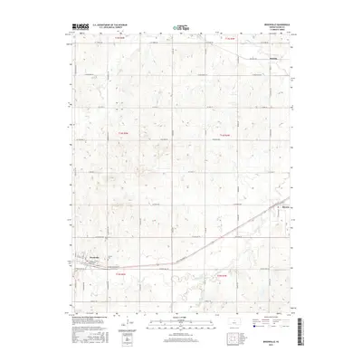
2015 Map of Brookville
USGS Topo · Published 2015About this map
Brookville and its surrounding township sections are defined by the intersection of historic transit routes and prairie waterways. W Old Highway 40 cuts a diagonal path through the southern half of the landscape, passing through Bavaria and continuing west. The area's local history is anchored by the proximity of Brookville Cem and Calvary Cem, situated just north of the primary settlement.
Find a feature on this map
53 named features on this map. Tap any name to fly to it.
Don’t see what you’re looking for? This feature index may not catch every label — zoom into the map to look around manually.
Map Details
Editions of this 2015 Brookville Map
This is the sole edition of this map. No revisions or reprints were ever made.
Other maps of this area

1892 · Salina
USGS Topo · 1:125,000

1942 · Salina
USGS Topo · 1:125,000

1955 · Salina SW
USGS Topo · 1:24,000

1955 · Trenton
USGS Topo · 1:24,000

1955 · Smolan
USGS Topo · 1:24,000

1955 · Brookville
USGS Topo · 1:24,000

1955 · Culver
USGS Topo · 1:24,000

1955 · Falun
USGS Topo · 1:24,000

1955 · Hutchinson
USGS Topo · 1:250,000

1957 · Brookville SW
USGS Topo · 1:24,000