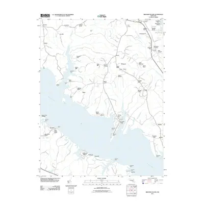
2011 Map of Broomes Island
USGS Topo · Published 2011About this map
Broomes Island sits at the southern tip of a peninsula formed by the Patuxent River and Island Creek, serving as a focal point for maritime activity in this part of Calvert County. The landscape is characterized by a series of deep tidal creeks, including Battle Creek and Saint Leonard Creek, which have shaped the settlement patterns of communities like Mutual, Hellen, and Adelina. The numerous historical landing sites such as Parker Wharf and Briscoe Wharf point to the long-standing importance of waterborne transport and trade along these shores.
Find a feature on this map
133 named features on this map. Tap any name to fly to it.
Don’t see what you’re looking for? This feature index may not catch every label — zoom into the map to look around manually.
Map Details
Editions of this 2011 Broomes Island Map
This is the sole edition of this map. No revisions or reprints were ever made.
Other maps of this area

1892 · Leonardtown
USGS Topo · 1:62,500

1892 · Drum Point
USGS Topo · 1:62,500

1892 · Prince Frederick
USGS Topo · 1:62,500

1893 · Sharps Island
USGS Topo · 1:62,500

1895 · Prince Frederick
USGS Topo · 1:62,500

1895 · Leonardtown
USGS Topo · 1:62,500

1895 · Nomini
USGS Topo · 1:125,000

1898 · Choptank
USGS Topo · 1:125,000

1898 · Nomini
USGS Topo · 1:125,000

1898 · St. Marys
USGS Topo · 1:125,000