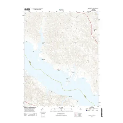
2014 Map of Broomes Island
USGS Topo · Published 2014About this map
Broomes Island and the surrounding Chesapeake Bay inlets define the landscape of this Calvert County peninsula during the early 21st century. The map illustrates a coastline deeply etched by tidal waters, where Parker Wharf and Briscoe serve as points of contact between the land and the Patuxent River. The interior is marked by a network of local roads including Parran Rd and Mackall Rd, which connect established settlements like Saint Leonard to the various points and coves along the shore.
Find a feature on this map
37 named features on this map. Tap any name to fly to it.
Don’t see what you’re looking for? This feature index may not catch every label — zoom into the map to look around manually.
Map Details
Editions of this 2014 Broomes Island Map
This is the sole edition of this map. No revisions or reprints were ever made.
Other maps of this area

1892 · Leonardtown
USGS Topo · 1:62,500

1892 · Drum Point
USGS Topo · 1:62,500

1892 · Prince Frederick
USGS Topo · 1:62,500

1893 · Sharps Island
USGS Topo · 1:62,500

1895 · Prince Frederick
USGS Topo · 1:62,500

1895 · Leonardtown
USGS Topo · 1:62,500

1895 · Nomini
USGS Topo · 1:125,000

1898 · Choptank
USGS Topo · 1:125,000

1898 · Nomini
USGS Topo · 1:125,000

1898 · St. Marys
USGS Topo · 1:125,000