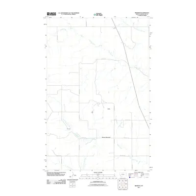
2011 Map of Brorson
USGS Topo · Published 2011About this map
Brorson (historical) serves as the focal point of this Eastern Montana landscape, where the agricultural traditions of Richland County meet modern energy extraction. The intersection of local county roads, such as County Rd-129 and County Rd-344, defines the historical movement through this prairie terrain. The influence of the Brorson Oil Field is evident near the center of the map, illustrating the region's industrial footprint alongside traditional water management features like Albin Dam and Coon Dam. Several waterways, including Brorson Creek and the North Fork First Hay Creek, create a dendritic drainage pattern across the high plains. This 2011 survey captures a specific moment in the evolution of this rural landscape, documenting the persistent name of Four Corners and the extensive network of farm-to-market roads that connect these isolated sites.
Find a feature on this map
20 named features on this map. Tap any name to fly to it.
Don’t see what you’re looking for? This feature index may not catch every label — zoom into the map to look around manually.
Map Details
Editions of this 2011 Brorson Map
This is the sole edition of this map. No revisions or reprints were ever made.
Other maps of this area

1909 · Glendive
USGS Topo · 1:250,000

1954 · Glendive
USGS Topo · 1:250,000

1957 · Glendive
USGS Topo · 1:250,000

1958 · Glendive
USGS Topo · 1:250,000

1966 · Crane NE
USGS Topo · 1:24,000

1966 · Crane NW
USGS Topo · 1:24,000

1966 · Sidney
USGS Topo · 1:24,000

1972 · Brorson
USGS Topo · 1:24,000

1972 · Girard
USGS Topo · 1:24,000
1972 · Fairview NW
USGS Topo · 1:24,000