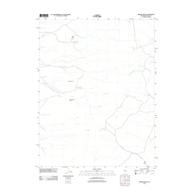
2012 Map of Brown Knoll
USGS Topo · Published 2012About this map
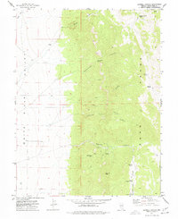
Milk Ranch Creek and its surrounding high-desert terrain define this portion of White Pine County, where water sources were the primary drivers of land use. In this remote 2012 survey, the map reveals a landscape dotted with specific, named springs such as First Sawmill Spring, Chimney Rock Spring, and Schoolhouse Spring, indicating historical points of survival and seasonal occupation. The presence of Milk Ranch Corral and Schoolhouse Canyon suggests a history of ranching and early community infrastructure that relied on the intermittent flows of Cave Valley Wash. Man-made water management is evident in the White Knoll Reservoir and Brown Knoll Reservoir, strategically placed near the prominent peaks of White Knoll and Brown Knoll. This map offers a clear look at the network of drainages like Silver Creek and isolated landmarks such as Hole in the Bank Spring that have long dictated movement through this arid region.
Find a feature on this map
24 named features on this map. Tap any name to fly to it.
Don’t see what you’re looking for? This feature index may not catch every label — zoom into the map to look around manually.
Map Details
Editions of this 2012 Brown Knoll Map
This is the sole edition of this map. No revisions or reprints were ever made.
Other maps of this area

1956 · Lund
USGS Topo · 1:250,000

1960 · Lund
USGS Topo · 1:250,000

1969 · Parker Station
USGS Topo · 1:24,000

1969 · Moorman Spring NE
USGS Topo · 1:24,000

1969 · Haggerty Spring
USGS Topo · 1:24,000
1973 · White Rock Creek
USGS Topo · 1:24,000
1977 · Bullwhack Summit
USGS Topo · 1:24,000
1977 · Brown Knoll
USGS Topo · 1:24,000
1977 · Sawmill Canyon
USGS Topo · 1:24,000
1978 · Lund
USGS Topo · 1:24,000