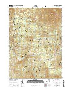
2014 Map of Brown Mountain
USGS Topo · Published 2014About this map
Winema National Forest and the Rogue River National Forest meet along the high divide of the Southern Cascades, where the boundary between Jackson and Klamath counties follows the crest. This high-elevation landscape is defined by volcanic features like Brown Mountain, Robinson Butte, and Cox Butte. A significant portion of the Pacific Crest National Scenic Trail winds through these forests, crossing a network of resource roads such as Brown Mountain Rd and Big Elk Rd. Water sources are sparse but critical in this volcanic terrain, including the Manley Reservoir and the seasonal flows of Daley Cr and Beaver Dam Cr. The map captures the quiet transition of Daley Prairie, where the topography softens before climbing toward the prominent peak of Burton Butte in the east.
Find a feature on this map
37 named features on this map. Tap any name to fly to it.
Don’t see what you’re looking for? This feature index may not catch every label — zoom into the map to look around manually.
Map Details
Editions of this 2014 Brown Mountain Map
This is the sole edition of this map. No revisions or reprints were ever made.
Other maps of this area

1891 · Ashland
USGS Topo · 1:250,000

1893 · Ashland
USGS Topo · 1:250,000

1897 · Ashland
USGS Topo · 1:250,000

1955 · Lake O' Woods
USGS Topo · 1:62,500

1955 · Surveyor Mtn
USGS Topo · 1:62,500

1955 · Hyatt Reservoir
USGS Topo · 1:62,500

1955 · Mt. Mc Loughlin
USGS Topo · 1:62,500

1955 · Medford
USGS Topo · 1:250,000

1957 · Medford
USGS Topo · 1:250,000

1958 · Medford
USGS Topo · 1:250,000