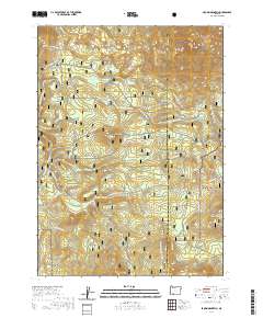
2020 Map of Brown Mountain
USGS Topo · Published 2020About this map
Winema National Forest and Rogue River National Forest meet in this high-altitude landscape dominated by volcanic peaks and seasonal recreation corridors. The terrain is anchored by the prominent Brown Mtn and Robinson Butte, with the Pacific Crest National Scenic Trail winding through the eastern portion of the quadrangle. The map highlights a specialized network of snowmobile and nordic trails, such as the Robinson Butte Loop Snomo and Glasgow Loop Nordic, which trace the contours of the Cascades. Industrial activity is represented by the Big Elk Cinder Pit near the northern boundary, while water management is noted at Manley Reservoir along Beaver Dam Cr. Historical transit is marked by the Dead Indian Memorial Road, crossing the southern half of the map.
Find a feature on this map
44 named features on this map. Tap any name to fly to it.
Don’t see what you’re looking for? This feature index may not catch every label — zoom into the map to look around manually.
Map Details
Editions of this 2020 Brown Mountain Map
This is the sole edition of this map. No revisions or reprints were ever made.
Other maps of this area

1891 · Ashland
USGS Topo · 1:250,000

1893 · Ashland
USGS Topo · 1:250,000

1897 · Ashland
USGS Topo · 1:250,000

1955 · Lake O' Woods
USGS Topo · 1:62,500

1955 · Surveyor Mtn
USGS Topo · 1:62,500

1955 · Hyatt Reservoir
USGS Topo · 1:62,500

1955 · Mt. Mc Loughlin
USGS Topo · 1:62,500

1955 · Medford
USGS Topo · 1:250,000

1957 · Medford
USGS Topo · 1:250,000

1958 · Medford
USGS Topo · 1:250,000