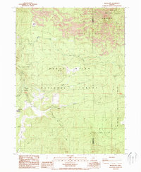
1988 Map of Brown Mountain
USGS Topo · Published 1988About this map
Brown Mtn dominates the northeastern landscape of this territory, where the volcanic terrain meets the high timberlands of the Southern Cascades in the late 1980s. The map documents a rugged high-country intersection of water and passage, marked by the confluence of the South Fork and Little Butte Creek. Evidence of federal land management and recreational infrastructure is central to the sheet, featuring the Pacific Crest National Scenic Trail as it winds through the Winema National Forest. A series of significant high-altitude openings, including Big Elk Meadow, Daley Prairie, and Deadwood Prairie, punctuate the heavy forest cover. These natural clearings provided critical points for administrative outposts like the Big Elk FS Station and road connections at Deadwood Junction. The presence of the Jackson Co Klamath Co line indicates the administrative boundary between these two southern Oregon regions.
Find a feature on this map
23 named features on this map. Tap any name to fly to it.
Don’t see what you’re looking for? This feature index may not catch every label — zoom into the map to look around manually.
Map Details
Editions of this 1988 Brown Mountain Map
This is the sole edition of this map. No revisions or reprints were ever made.
Other maps of this area

1891 · Ashland
USGS Topo · 1:250,000

1893 · Ashland
USGS Topo · 1:250,000

1897 · Ashland
USGS Topo · 1:250,000

1955 · Lake O' Woods
USGS Topo · 1:62,500

1955 · Surveyor Mtn
USGS Topo · 1:62,500

1955 · Hyatt Reservoir
USGS Topo · 1:62,500

1955 · Mt. Mc Loughlin
USGS Topo · 1:62,500

1955 · Medford
USGS Topo · 1:250,000

1957 · Medford
USGS Topo · 1:250,000

1958 · Medford
USGS Topo · 1:250,000