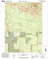
1998 Map of Brown Mountain
USGS Topo · Published 2000About this map
Rogue River National Forest and Winema National Forest dominate this landscape, meeting at the jagged boundary of Jackson and Klamath counties. The terrain is defined by volcanic activity, with numerous lava flows surrounding Cox Butte and descending toward Big Elk Meadow. Historical forest management is evident at the Big Elk Guard Station and the Cinder Pit near the eastern boundary. The intricate drainage network includes the South Fork Little Butte Creek and Beaver Dam Creek, which support localized infrastructure like the Pole Bridge Creek Canal. Connectivity through this high-country area is anchored by the Dead Indian Memorial Road and the Scenic Trail, marking a region transition between dense timberlands and open clearings like Prairie.
Find a feature on this map
21 named features on this map. Tap any name to fly to it.
Don’t see what you’re looking for? This feature index may not catch every label — zoom into the map to look around manually.
Map Details
Editions of this 1998 Brown Mountain Map
This is the sole edition of this map. No revisions or reprints were ever made.
Other maps of this area

1891 · Ashland
USGS Topo · 1:250,000

1893 · Ashland
USGS Topo · 1:250,000

1897 · Ashland
USGS Topo · 1:250,000

1955 · Lake O' Woods
USGS Topo · 1:62,500

1955 · Surveyor Mtn
USGS Topo · 1:62,500

1955 · Hyatt Reservoir
USGS Topo · 1:62,500

1955 · Mt. Mc Loughlin
USGS Topo · 1:62,500

1955 · Medford
USGS Topo · 1:250,000

1957 · Medford
USGS Topo · 1:250,000

1958 · Medford
USGS Topo · 1:250,000