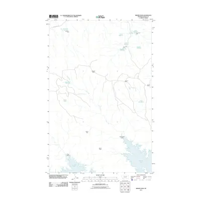
2011 Map of Brown Pass
USGS Topo · Published 2011About this map
Fort Peck Lake defines the southern reach of this Valley County landscape, where the Missouri River drainage shapes a complex network of coulees and ridges. The terrain rises northward from King Coulee toward the high ground of Brown Ridge and Shufeldt Ridge, which frame the central passage of Brown Pass. This 2011 survey documents a remote ranching environment characterized by extensive water management, with numerous small impoundments such as Chico Reservoir, Half Barrel Reservoir, and Soufly Reservoir dotting the drainages. These features, alongside established outposts like Magruder Ranch and Wittmayer Ranch, illustrate the intersection of local cattle operations and the semi-arid hydrology of the high plains. Natural water sources like Needle Spring and the winding course of Duck Creek remain vital markers in this sparsely populated portion of Montana.
Find a feature on this map
23 named features on this map. Tap any name to fly to it.
Don’t see what you’re looking for? This feature index may not catch every label — zoom into the map to look around manually.
Map Details
Editions of this 2011 Brown Pass Map
This is the sole edition of this map. No revisions or reprints were ever made.
Other maps of this area

1954 · Jordan
USGS Topo · 1:250,000

1956 · Jordan
USGS Topo · 1:250,000

1958 · Jordan
USGS Topo · 1:250,000

1958 · Collins Ranch
USGS Topo · 1:62,500

1958 · Maloney Hill
USGS Topo · 1:62,500

1964 · Jordan
USGS Topo · 1:250,000

1971 · Harper Camp
USGS Topo · 1:24,000
1973 · Triple Crossing Reservoir East
USGS Topo · 1:24,000
1973 · Murray Hill
USGS Topo · 1:24,000

1978 · Fort Peck Lake West
USGS Topo · 1:100,000