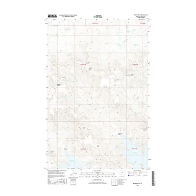
2017 Map of Brown Pass
USGS Topo · Published 2017About this map
Fort Peck Lake dominates the southern edge of this landscape, its shoreline reaching into Sutherland Creek Bay. The terrain north of the lake is a complex system of drainage and ridges, including the prominent Brown Ridge and Van Hook Ridge. The area is characterized by numerous small-scale water management features such as Half Barrel Detention Reservoir, Prairie Reservoir, and Duck Soup Reservoir, which are vital for supporting local ranching operations in this arid environment.
Find a feature on this map
33 named features on this map. Tap any name to fly to it.
Don’t see what you’re looking for? This feature index may not catch every label — zoom into the map to look around manually.
Map Details
Editions of this 2017 Brown Pass Map
This is the sole edition of this map. No revisions or reprints were ever made.
Other maps of this area

1954 · Jordan
USGS Topo · 1:250,000

1956 · Jordan
USGS Topo · 1:250,000

1958 · Jordan
USGS Topo · 1:250,000

1958 · Collins Ranch
USGS Topo · 1:62,500

1958 · Maloney Hill
USGS Topo · 1:62,500

1964 · Jordan
USGS Topo · 1:250,000

1971 · Harper Camp
USGS Topo · 1:24,000
1973 · Triple Crossing Reservoir East
USGS Topo · 1:24,000
1973 · Murray Hill
USGS Topo · 1:24,000

1978 · Fort Peck Lake West
USGS Topo · 1:100,000