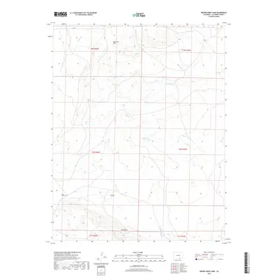
2019 Map of Brown Sheep Camp
USGS Topo · Published 2019About this map
Brown Sheep Camp sits as a solitary named point of settlement within this arid drainage basin in southern Las Animas County. The landscape is defined by a series of seasonal watercourses, including Big Arroyo, Taylor Arroyo, Burke Arroyo, and Van Bremer Arroyo, which carve through the high plains. Significant topographical features like The Hogback and Big Arroyo Hills provide vertical relief in an area primarily used for grazing and ranching operations. At The Gap, the terrain funnels between elevated landforms, illustrating the natural travel corridors used in this part of the state. The presence of Co RD 70 and Co RD 54 indicates the sparse but essential road network connecting these remote camps and range lands, while the township and range lines of the Public Land Survey System underscore the orderly division of the American West.
Find a feature on this map
16 named features on this map. Tap any name to fly to it.
Don’t see what you’re looking for? This feature index may not catch every label — zoom into the map to look around manually.
Map Details
Editions of this 2019 Brown Sheep Camp Map
This is the sole edition of this map. No revisions or reprints were ever made.
Other maps of this area

1891 · Timpas
USGS Topo · 1:125,000

1891 · Apishapa
USGS Topo · 1:125,000

1891 · Mesa De Maya
USGS Topo · 1:125,000

1892 · Elmoro
USGS Topo · 1:125,000

1893 · Apishapa
USGS Topo · 1:125,000

1893 · Elmoro
USGS Topo · 1:125,000

1893 · Mesa de Maya
USGS Topo · 1:125,000

1894 · Timpas
USGS Topo · 1:125,000

1897 · Elmoro
USGS Topo · 1:125,000

1897 · Apishapa
USGS Topo · 1:125,000