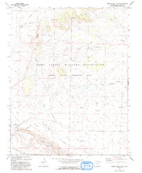
1993 Map of Brown Sheep Camp
USGS Topo · Published 1993About this map
Fort Carson Military Reservation dominates this 1993 topographical study of the Las Animas County high plains, specifically the Piñon Canyon Maneuver Site. The landscape is defined by a network of drainage channels including Big Arroyo, Burke Arroyo, and Van Bremer Arroyo, which cut through the arid terrain. The map records a sparse human imprint concentrated on ranching and military utility, featuring remote outposts like Brown Sheep Camp and Burson Camp.
Find a feature on this map
28 named features on this map. Tap any name to fly to it.
Don’t see what you’re looking for? This feature index may not catch every label — zoom into the map to look around manually.
Map Details
Editions of this 1993 Brown Sheep Camp Map
This is the sole edition of this map. No revisions or reprints were ever made.
Other maps of this area

1891 · Timpas
USGS Topo · 1:125,000

1891 · Apishapa
USGS Topo · 1:125,000

1891 · Mesa De Maya
USGS Topo · 1:125,000

1892 · Elmoro
USGS Topo · 1:125,000

1893 · Apishapa
USGS Topo · 1:125,000

1893 · Elmoro
USGS Topo · 1:125,000

1893 · Mesa de Maya
USGS Topo · 1:125,000

1894 · Timpas
USGS Topo · 1:125,000

1897 · Elmoro
USGS Topo · 1:125,000

1897 · Apishapa
USGS Topo · 1:125,000