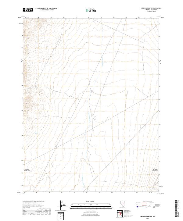
2021 Map of Brown Summit SW
USGS Topo · Published 2021About this map
Sand Springs Wash carves a long, linear path through this high-desert portion of Nye County, serving as the dominant drainage feature across a landscape defined by dramatic elevation changes. The terrain rises sharply towards the western edge of the quadrangle, with prominent ridges and alluvial fans characteristic of the Great Basin region. This 2021 topographic record reveals the sparse, wide-open character of the area, where the vast majority of the land is managed through the Public Land Survey System as indicated by the grid of township and range lines. The lack of modern residential development or improved roads suggests a landscape largely used for grazing, resource management, or conservation, typical of the remote interior of southern Nevada.
Find a feature on this map
1 named feature on this map. Tap any name to fly to it.
Don’t see what you’re looking for? This feature index may not catch every label — zoom into the map to look around manually.
Map Details
Editions of this 2021 Brown Summit SW Map
This is the sole edition of this map. No revisions or reprints were ever made.
Other maps of this area

1956 · Lund
USGS Topo · 1:250,000

1956 · Tonopah
USGS Topo · 1:250,000

1959 · Tonopah
USGS Topo · 1:250,000

1960 · Lund
USGS Topo · 1:250,000

1962 · Tonopah
USGS Topo · 1:250,000

1967 · Moores Station
USGS Topo · 1:62,500

1967 · Chaos Creek
USGS Topo · 1:24,000

1968 · Portuguese Mtn
USGS Topo · 1:62,500

1968 · Brown Summit
USGS Topo · 1:24,000
1968 · Brown Summit NW
USGS Topo · 1:24,000