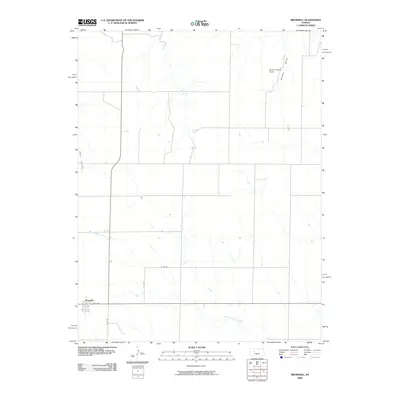
2009 Map of Brownell
USGS Topo · Published 2009About this map
Brownell anchors the southwestern corner of this West Central Kansas landscape, where the town site is defined by a grid including Davis Ave and N BB Rd. The surrounding terrain is carved by a network of intermittent waterways, most notably the meandering course of Big Timber Creek and the smaller Tunnel Creek that flows through the central plains. These drainage patterns, including the northern Wildon Draw, reveal the subtle topographical shifts of the high plains.
Find a feature on this map
10 named features on this map. Tap any name to fly to it.
Don’t see what you’re looking for? This feature index may not catch every label — zoom into the map to look around manually.
Map Details
Editions of this 2009 Brownell Map
This is the sole edition of this map. No revisions or reprints were ever made.
Other maps of this area

1893 · Ellis
USGS Topo · 1:125,000

1955 · Great Bend
USGS Topo · 1:250,000

1957 · Great Bend
USGS Topo · 1:250,000

1958 · Great Bend
USGS Topo · 1:250,000

1965 · Mc Cracken
USGS Topo · 1:24,000

1966 · Ransom SE
USGS Topo · 1:24,000

1966 · Mc Cracken SW
USGS Topo · 1:24,000
1974 · Cedar Bluff Dam
USGS Topo · 1:24,000
1974 · Cedar Bluff
USGS Topo · 1:24,000
1974 · Ellis SE
USGS Topo · 1:24,000