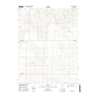
2015 Map of Brownell
USGS Topo · Published 2015About this map
The settlement of Brownell sits at the southern edge of this West Central Kansas landscape, where the prairie begins to break into the drainage systems of the Smoky Hill River valley. This 2015 survey reveals a terrain defined by subtle but distinct landmarks such as Round House Rock and the drainage of Wildon Draw to the northeast. The land is organized by the Public Land Survey System, with township and range lines like t15s r22w and t16s r21w dictating the modern road network, including Davis Ave and CC Rd.
Find a feature on this map
20 named features on this map. Tap any name to fly to it.
Don’t see what you’re looking for? This feature index may not catch every label — zoom into the map to look around manually.
Map Details
Editions of this 2015 Brownell Map
This is the sole edition of this map. No revisions or reprints were ever made.
Other maps of this area

1893 · Ellis
USGS Topo · 1:125,000

1955 · Great Bend
USGS Topo · 1:250,000

1957 · Great Bend
USGS Topo · 1:250,000

1958 · Great Bend
USGS Topo · 1:250,000

1965 · Mc Cracken
USGS Topo · 1:24,000

1966 · Ransom SE
USGS Topo · 1:24,000

1966 · Mc Cracken SW
USGS Topo · 1:24,000
1974 · Cedar Bluff Dam
USGS Topo · 1:24,000
1974 · Cedar Bluff
USGS Topo · 1:24,000
1974 · Ellis SE
USGS Topo · 1:24,000