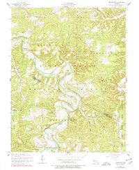
1954 Map of Brownfield
USGS Topo · Published 1977About this map
The Gasconade River winds through the heart of this mid-century landscape, carving deep valleys through the Mark Twain National Forest. This section of Pulaski and Laclede counties reveals a dispersed rural settlement pattern centered on the small community of Brownfield. The map is particularly rich for genealogical research, documenting numerous family-named burial grounds such as Rollins Cem, Nicks Cem, and Simpson Cem.
Find a feature on this map
29 named features on this map. Tap any name to fly to it.
Don’t see what you’re looking for? This feature index may not catch every label — zoom into the map to look around manually.
Map Details
Editions of this 1954 Brownfield Map
2 editions found
Other maps of this area

1936 · Waynesville
USGS Topo · 1:48,000

1941 · Big Piney
USGS Topo · 1:62,500

1942 · Waynesville
USGS Topo · 1:62,500

1943 · Richland
USGS Topo · 1:62,500

1943 · Big Piney
USGS Topo · 1:62,500

1943 · Drynob
USGS Topo · 1:62,500

1944 · Waynesville
USGS Topo · 1:62,500

1954 · Springfield
USGS Topo · 1:250,000

1954 · Drynob
USGS Topo · 1:62,500
1954 · Big Piney
USGS Topo · 1:62,500