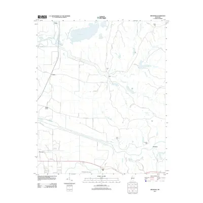
2012 Map of Browning
USGS Topo · Published 2012About this map
Malmaison and the surrounding Leflore County landscape are defined by the winding waterways of the Mississippi Delta. In this early 21st-century survey, the drainages of Teoc Cr and Big Sand Cr cut through a territory marked by family-named landmarks and rural settlements like Crenfree and Valley Hill. The map preserves the locations of several burial grounds, including the Greenwood LeFlore Cem and Mount Pisgah Cem, which serve as vital touchstones for genealogical research in this region. The northern section is dominated by the waters of Sharkey Bayou and the Yalobusha River, while the southern reaches show the infrastructure of the Greenwood-Leflore Airport. This layout illustrates a transition from the historic river-and-creek economy to modern transportation networks while maintaining its traditional crossroads at places like Bright Corner.
Find a feature on this map
73 named features on this map. Tap any name to fly to it.
Don’t see what you’re looking for? This feature index may not catch every label — zoom into the map to look around manually.
Map Details
Editions of this 2012 Browning Map
This is the sole edition of this map. No revisions or reprints were ever made.
Other maps of this area

1936 · Greenwood
USGS Topo · 1:62,500

1940 · Seven Pines
USGS Topo · 1:62,500

1940 · Greenwood
USGS Topo · 1:62,500

1953 · Greenwood
USGS Topo · 1:250,000

1953 · West Point
USGS Topo · 1:250,000

1954 · McCarley
USGS Topo · 1:62,500

1956 · Greenwood
USGS Topo · 1:250,000

1957 · Greenwood
USGS Topo · 1:62,500

1957 · Seven Pines
USGS Topo · 1:62,500

1958 · West Point
USGS Topo · 1:250,000