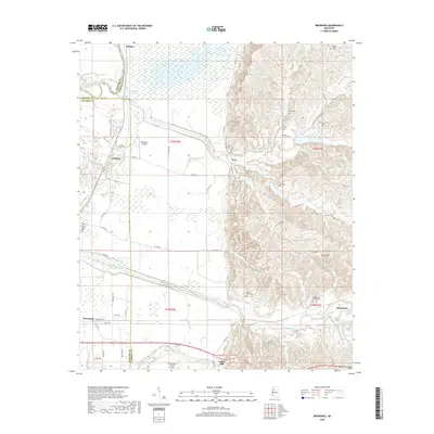
2018 Map of Browning
USGS Topo · Published 2018About this map
Sharkey Bayou and the meandering path of the Yalobusha River define the low-lying wetlands of the Mississippi Delta as they meet the rising bluffs of the north-central hills. This landscape transitions sharply at the Leflore and Carroll County line, where the flat alluvial plains give way to a dissected upland topography. The historic settlement of Malmaison and the nearby Greenwood LeFlore Cem sit at this geographic junction, preserving the name of the prominent Choctaw chieftain and statesman. Transportation through the region is marked by small aviation fields, including Henderson Airport and the larger Greenwood-Leflore Airport to the south. Rural life is anchored by scattered communities like Teoc, Whaley, and Crenfree, with several small family and community burial grounds such as Oak Grove Cem and Mount Pisgah Cem providing vital touchstones for local genealogical research.
Find a feature on this map
45 named features on this map. Tap any name to fly to it.
Don’t see what you’re looking for? This feature index may not catch every label — zoom into the map to look around manually.
Map Details
Editions of this 2018 Browning Map
This is the sole edition of this map. No revisions or reprints were ever made.
Other maps of this area

1936 · Greenwood
USGS Topo · 1:62,500

1940 · Seven Pines
USGS Topo · 1:62,500

1940 · Greenwood
USGS Topo · 1:62,500

1953 · Greenwood
USGS Topo · 1:250,000

1953 · West Point
USGS Topo · 1:250,000

1954 · McCarley
USGS Topo · 1:62,500

1956 · Greenwood
USGS Topo · 1:250,000

1957 · Greenwood
USGS Topo · 1:62,500

1957 · Seven Pines
USGS Topo · 1:62,500

1958 · West Point
USGS Topo · 1:250,000