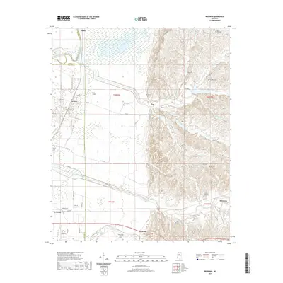
2021 Map of Browning
USGS Topo · Published 2021About this map
The Carroll County and Leflore County border runs through a landscape of contrasting geography, where the flat Mississippi Delta meets the rising bluffs to the east. The alluvial plain is dominated by managed water bodies and wetlands like Sharkey Bayou and Lightline Lake, while the eastern hills are deeply incised by the drainage systems of Teoc Creek and Little Teoc Creek. The area's history is anchored by family and community landmarks such as the Greenwood LeFlore Cemetery and Mount Olive Cemetery, reflecting generations of settlement near Valley Hill and Teoc. Transport and infrastructure are central to the region, with the Greenwood-Leflore Airport and Henderson Airport serving the area, while a dense network of county roads like Teoc Road and Malmaison Road connect the small communities and agricultural lands scattered across the terrain.
Find a feature on this map
74 named features on this map. Tap any name to fly to it.
Don’t see what you’re looking for? This feature index may not catch every label — zoom into the map to look around manually.
Map Details
Editions of this 2021 Browning Map
This is the sole edition of this map. No revisions or reprints were ever made.
Other maps of this area

1936 · Greenwood
USGS Topo · 1:62,500

1940 · Seven Pines
USGS Topo · 1:62,500

1940 · Greenwood
USGS Topo · 1:62,500

1953 · Greenwood
USGS Topo · 1:250,000

1953 · West Point
USGS Topo · 1:250,000

1954 · McCarley
USGS Topo · 1:62,500

1956 · Greenwood
USGS Topo · 1:250,000

1957 · Greenwood
USGS Topo · 1:62,500

1957 · Seven Pines
USGS Topo · 1:62,500

1958 · West Point
USGS Topo · 1:250,000