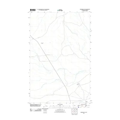
2011 Map of Browning NE
USGS Topo · Published 2011About this map
Birdrattler Cemetery serves as a significant local landmark on the southern edge of this landscape, situated near the confluence of local drainages and the banks of Cut Bank Creek. This high plains region of Glacier County is defined by the expansive Greasewood Flat and the branching networks of North Fork Greasewood Creek and South Fork Greasewood Creek. The map documents a sparse but vital rural infrastructure, where routes such as Arnoux Trl and Mc Allister Rd cross the terrain near prominent high points like Houseman Hill. The presence of these named family roads and cemeteries provides essential geographical context for genealogists and local historians tracing the twentieth-century settlement patterns of the Montana frontier. To the east, Boundary Creek defines the physical limits of this survey, which captures the intersection of natural watercourses and established ranching corridors.
Find a feature on this map
12 named features on this map. Tap any name to fly to it.
Don’t see what you’re looking for? This feature index may not catch every label — zoom into the map to look around manually.
Map Details
Editions of this 2011 Browning NE Map
This is the sole edition of this map. No revisions or reprints were ever made.
Other maps of this area

1901 · Browning
USGS Topo · 1:125,000

1903 · Browning
USGS Topo · 1:125,000

1911 · Blackfoot
USGS Topo · 1:125,000

1960 · Cut Bank
USGS Topo · 1:250,000

1963 · Cut Bank
USGS Topo · 1:250,000

1964 · Cut Bank
USGS Topo · 1:250,000

1968 · Hoodoo Hill
USGS Topo · 1:24,000

1968 · Browning NE
USGS Topo · 1:24,000
1968 · Browning
USGS Topo · 1:24,000
1968 · Starr School
USGS Topo · 1:24,000