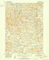
1951 Map of Brownlee
USGS Topo · Published 1951About this map
The North Loup River meanders across this northern Nebraska landscape, defining a region of sprawling cattle operations and complex hydrology in Cherry County. Settled ranching life is well-documented here, with family names marking the land at the Richardson Ranch, M Lee Ranch, and Pearson Ranch. The northern portion of the quadrangle is dominated by the Valentine National Wildlife Refuge, a dense network of sandhills lakes including Dads Lake, Pony Lake, and the uniquely named Devils Punch Bowl Lake. This 1951 record captures a era of rural education, preserving the locations of numerous district schoolhouses such as School No 37 and School No 108. Between the Lee Flats and the Wamaduze Valley, the settlement of Brownlee serves as the central hub for this remote ranching community, situated at a transition between the river valley and the lake-studded hills to the north.
Find a feature on this map
62 named features on this map. Tap any name to fly to it.
Don’t see what you’re looking for? This feature index may not catch every label — zoom into the map to look around manually.
Map Details
Editions of this 1951 Brownlee Map
2 editions found

Other maps of this area

1948 · Seneca
USGS Topo · 1:62,500

1948 · Seneca 4
USGS Topo · 1:62,500

1949 · Seneca 4
USGS Topo · 1:62,500

1949 · Purdum
USGS Topo · 1:62,500

1949 · Long Lake
USGS Topo · 1:62,500

1950 · Simeon
USGS Topo · 1:62,500

1950 · Kennedy
USGS Topo · 1:62,500

1950 · Arabia
USGS Topo · 1:62,500

1951 · Long Lake
USGS Topo · 1:62,500

1951 · Seneca
USGS Topo · 1:62,500