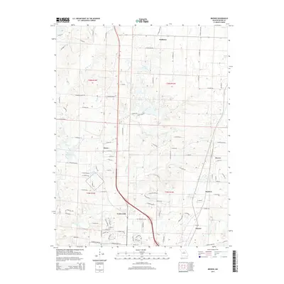
2014 Map of Browns
USGS Topo · Published 2014About this map
Hinton and Prathersville anchor the central corridor of this Boone County landscape, illustrating a classic Missouri pattern of dispersed rural communities and small crossroads settlements. The region is defined by an intricate network of waterways, with the Silver Fork and Rocky Fork Creek carving through the terrain to the north and west, while the eastern section is marked by Clays Fork and the community of Browns. These natural drainages influence the local road network, which transitions from named paths like N Tucker School Rd and N Barnes School Rd to newer residential developments. Several small bodies of water, including Lake Caroline and Bo Co Mo Lake, punctuate the landscape, serving as local landmarks among the older farmstead sites. This era of the map captures the community just as the rural character began to meet more modern residential expansion around the southern fringes of the quadrangle.
Find a feature on this map
103 named features on this map. Tap any name to fly to it.
Don’t see what you’re looking for? This feature index may not catch every label — zoom into the map to look around manually.
Map Details
Editions of this 2014 Browns Map
This is the sole edition of this map. No revisions or reprints were ever made.
Other maps of this area

1886 · Jefferson City
USGS Topo · 1:125,000

1890 · Moberly
USGS Topo · 1:125,000

1894 · Jefferson City
USGS Topo · 1:125,000

1917 · Sturgeon
USGS Topo · 1:62,500

1935 · Columbia
USGS Topo · 1:24,000

1940 · Columbia
USGS Topo · 1:24,000

1944 · Millersburg
USGS Topo · 1:62,500

1945 · Centralia
USGS Topo · 1:62,500

1946 · Millersburg
USGS Topo · 1:62,500

1947 · Jefferson City
USGS Topo · 1:250,000