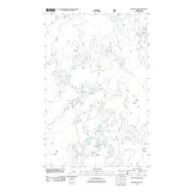
2011 Map of Browns Lake
USGS Topo · Published 2011About this map
Browns Lake and a series of high-altitude watchpoints define this high-country landscape in the Selkirk Mountains region. The network of peaks, including South Baldy and Kings Mountain, are notable for their numerous fire detection stations such as the South Baldy Lookout and Moon Hill Lookout. These sites reflect a long history of forest management and fire suppression across the northern Washington backcountry.
Find a feature on this map
33 named features on this map. Tap any name to fly to it.
Don’t see what you’re looking for? This feature index may not catch every label — zoom into the map to look around manually.
Map Details
Editions of this 2011 Browns Lake Map
This is the sole edition of this map. No revisions or reprints were ever made.
Other maps of this area

1934 · Metaline
USGS Topo · 1:125,000

1936 · Newport
USGS Topo · 1:96,000

1942 · Metaline
USGS Topo · 1:125,000

1942 · Newport
USGS Topo · 1:125,000

1958 · Sandpoint
USGS Topo · 1:250,000

1963 · Sandpoint
USGS Topo · 1:250,000
1967 · North Baldy
USGS Topo · 1:24,000
1967 · Gleason Mtn
USGS Topo · 1:24,000
1967 · Ruby
USGS Topo · 1:24,000

1968 · Cusick
USGS Topo · 1:24,000