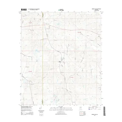
2015 Map of Browns Lake
USGS Topo · Published 2015About this map
The Smith Town area of southern Mississippi is defined by its network of creeks and timberland, situated along the border of Pearl River and Stone Counties. The landscape is dominated by the winding course of the Biloxi River and the Juniper, Cypress, and Murder creeks. Numerous small lakes and reservoirs, including Browns Lake, Lake Toc-O-Leen, and Holiday Lake, punctuate the terrain, reflecting the region's hydrologic character.
Find a feature on this map
81 named features on this map. Tap any name to fly to it.
Don’t see what you’re looking for? This feature index may not catch every label — zoom into the map to look around manually.
Map Details
Editions of this 2015 Browns Lake Map
This is the sole edition of this map. No revisions or reprints were ever made.
Other maps of this area

1947 · Wiggins
USGS Topo · 1:62,500

1949 · Wiggins
USGS Topo · 1:62,500

1953 · Mobile
USGS Topo · 1:250,000

1954 · McHenry
USGS Topo · 1:62,500

1955 · Savannah
USGS Topo · 1:62,500

1957 · Mobile
USGS Topo · 1:250,000

1958 · Carnes
USGS Topo · 1:62,500

1960 · Mobile
USGS Topo · 1:250,000

1963 · Mobile
USGS Topo · 1:250,000

1965 · Mobile
USGS Topo · 1:250,000