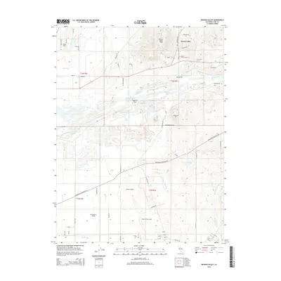
2015 Map of Browns Valley
USGS Topo · Published 2015About this map
Browns Valley sits at the foot of the Browns Valley Ridge, marking a transition from the lower Sacramento Valley to the rising terrain of the northeast. This 2015 update of Yuba County geography documents the complex hydrology of the Yuba River corridor, where the Daguerre Point area and Marysville Lake dominate the central landscape. The settlement of Hammonton is located just south of the river, while the northern sections are defined by landmarks such as the Browns Valley Cemetery and the Trainer Hills. The southern portion of the map is significantly occupied by the northern reaches of Beale Air Force Base, showing a military presence alongside agricultural and riparian zones. Water management is a clear theme, illustrated by the presence of the Cordua Canal and numerous seasonal creeks like Reeds Cr and Jack Slough.
Find a feature on this map
69 named features on this map. Tap any name to fly to it.
Don’t see what you’re looking for? This feature index may not catch every label — zoom into the map to look around manually.
Map Details
Editions of this 2015 Browns Valley Map
This is the sole edition of this map. No revisions or reprints were ever made.
Other maps of this area

1888 · Marysville
USGS Topo · 1:125,000

1888 · Smartsville
USGS Topo · 1:125,000

1891 · Marysville
USGS Topo · 1:125,000

1891 · Smartsville
USGS Topo · 1:125,000

1892 · Smartsville
USGS Topo · 1:125,000

1894 · Smartsville
USGS Topo · 1:125,000

1894 · Marysville
USGS Topo · 1:125,000

1895 · Marysville
USGS Topo · 1:125,000

1895 · Smartsville
USGS Topo · 1:125,000

1910 · Wheatland
USGS Topo · 1:31,680