
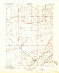
1910 Map of Wheatland
USGS Topo · Published 1910About this map
The Johnson Rancho land grant dominates this portion of the Sacramento Valley, illustrating the transition from large-scale Mexican-era ranchos to early twentieth-century agriculture. At the center of this landscape is Wheatland, a growing rail town situated along the Southern Pacific R. R. and the Marysville Line. The map reveals a community supported by local education and commerce, marked by the locations of Eagle School and Elizabeth School, as well as the small settlements of Erle and Horstville.
Find a feature on this map
16 named features on this map. Tap any name to fly to it.
Don’t see what you’re looking for? This feature index may not catch every label — zoom into the map to look around manually.
Map Details
Editions of this 1910 Wheatland Map
2 editions found
Other maps of this area

1888 · Marysville
USGS Topo · 1:125,000

1888 · Smartsville
USGS Topo · 1:125,000

1891 · Sacramento
USGS Topo · 1:125,000

1891 · Marysville
USGS Topo · 1:125,000

1891 · Smartsville
USGS Topo · 1:125,000

1892 · Sacramento
USGS Topo · 1:125,000

1892 · Smartsville
USGS Topo · 1:125,000

1893 · Sacramento
USGS Topo · 1:125,000

1894 · Smartsville
USGS Topo · 1:125,000

1894 · Marysville
USGS Topo · 1:125,000