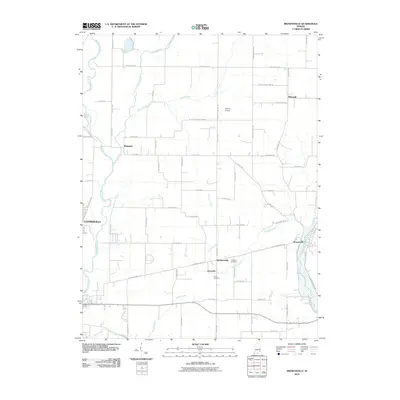
2010 Map of Brownsville
USGS Topo · Published 2010About this map
Brownsville and the surrounding agricultural landscape of Fayette and Union Counties are defined by the convergence of several major waterways. The Whitewater River and its East Fork carve through the terrain, joined by tributaries such as Nolands Fork, Butlers Creek, and Simpson Creek. This network of water supported early settlement patterns still visible in the distribution of small communities like Waterloo, Lyonsville, and the crossroad hamlet of Philomath.
Find a feature on this map
70 named features on this map. Tap any name to fly to it.
Don’t see what you’re looking for? This feature index may not catch every label — zoom into the map to look around manually.
Map Details
Editions of this 2010 Brownsville Map
This is the sole edition of this map. No revisions or reprints were ever made.
Other maps of this area

1915 · New Paris
USGS Topo · 1:48,000

1915 · College Corner
USGS Topo · 1:48,000

1918 · College Corner
USGS Topo · 1:62,500

1918 · New Paris
USGS Topo · 1:62,500

1948 · Fairfield
USGS Topo · 1:24,000

1953 · Cincinnati
USGS Topo · 1:250,000

1956 · Everton
USGS Topo · 1:24,000

1956 · Alpine
USGS Topo · 1:24,000

1956 · Brownsville
USGS Topo · 1:24,000

1956 · Connersville
USGS Topo · 1:24,000