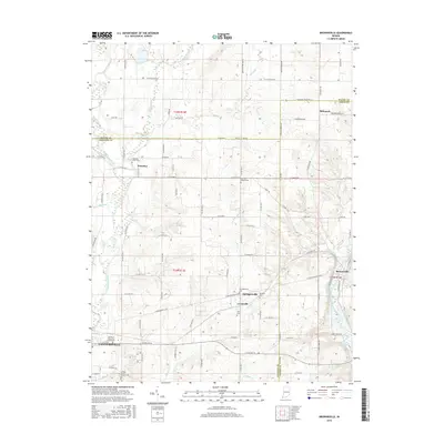
2016 Map of Brownsville
USGS Topo · Published 2016About this map
Connersville and the rural townships of Fayette and Union Counties are defined by the convergence of several major watercourses, including the Whitewater River, Nolands Fork, and the East Fork Whitewater River. This 2016 survey illustrates the persistent agricultural and small-town character of eastern Indiana, where local life remains anchored by crossroads like Lyonsville and Springersville. The landscape is dotted with markers of local heritage and family history, from the Shrine of Memories Mausoleum on the edge of town to numerous country burial grounds such as Village Creek Church Cem and Robinson Chapel Cem. The drainage patterns of Butlers Cr and Simpson Cr shape the terrain, influencing the layout of county roads that have connected these communities for generations.
Find a feature on this map
69 named features on this map. Tap any name to fly to it.
Don’t see what you’re looking for? This feature index may not catch every label — zoom into the map to look around manually.
Map Details
Editions of this 2016 Brownsville Map
This is the sole edition of this map. No revisions or reprints were ever made.
Other maps of this area

1915 · New Paris
USGS Topo · 1:48,000

1915 · College Corner
USGS Topo · 1:48,000

1918 · College Corner
USGS Topo · 1:62,500

1918 · New Paris
USGS Topo · 1:62,500

1948 · Fairfield
USGS Topo · 1:24,000

1953 · Cincinnati
USGS Topo · 1:250,000

1956 · Everton
USGS Topo · 1:24,000

1956 · Alpine
USGS Topo · 1:24,000

1956 · Brownsville
USGS Topo · 1:24,000

1956 · Connersville
USGS Topo · 1:24,000