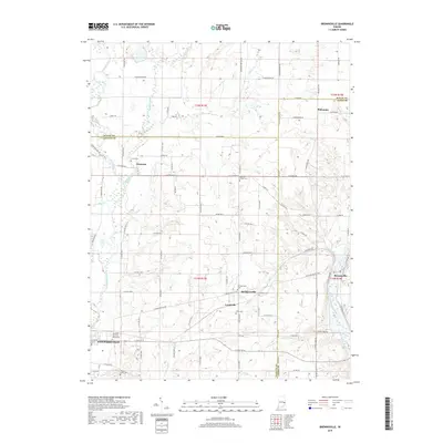
2019 Map of Brownsville
USGS Topo · Published 2019About this map
Whitewater River and its forks define the drainage of this East Central Indiana landscape, where the borders of Wayne, Fayette, and Union counties converge. Small agricultural settlements like Waterloo and Philomath anchor the northern reaches, while the southeastern corner is dominated by the course of the East Fork Whitewater River near Brownsville. The area exhibits a dense network of country roads following the township and range lines, connecting numerous local burial grounds including Union Cem, Village Creek Cem, and Robinson Chapel Cem. On the western edge, the outskirts of Connersville appear, featuring the Shrine of Memories Mausoleum. This 2019 survey documents the enduring rural character of the region, where waterways like Nolands Fork and Simpson Cr continue to shape the placement of historic farmsteads and small communities like Lyonsville and Springersville.
Find a feature on this map
97 named features on this map. Tap any name to fly to it.
Don’t see what you’re looking for? This feature index may not catch every label — zoom into the map to look around manually.
Map Details
Editions of this 2019 Brownsville Map
This is the sole edition of this map. No revisions or reprints were ever made.
Other maps of this area

1915 · New Paris
USGS Topo · 1:48,000

1915 · College Corner
USGS Topo · 1:48,000

1918 · College Corner
USGS Topo · 1:62,500

1918 · New Paris
USGS Topo · 1:62,500

1948 · Fairfield
USGS Topo · 1:24,000

1953 · Cincinnati
USGS Topo · 1:250,000

1956 · Everton
USGS Topo · 1:24,000

1956 · Alpine
USGS Topo · 1:24,000

1956 · Brownsville
USGS Topo · 1:24,000

1956 · Connersville
USGS Topo · 1:24,000