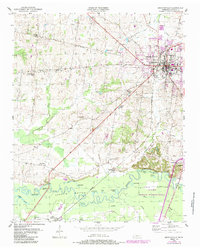
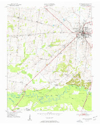
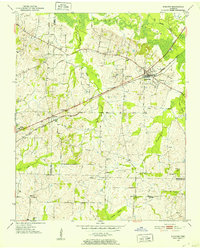
1950 Map of Brownsville
USGS Topo · Published 1983About this map
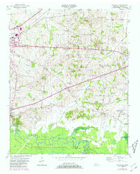
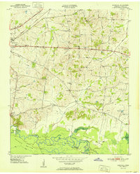
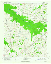
Hatchie River meanders through the expansive Hatchie Bottom at the southern edge of this West Tennessee landscape, where the Hatchie National Wildlife Refuge preserves a complex of oxbows and wetlands including Moon Lake, Bullpen Lake, and Swan Lake. The city of Brownsville serves as the regional anchor, showing its mid-century footprint with the County High Sch and Oakwood Cem prominent near the town center. Local commerce and transit are defined by the diagonal line of the Seaboard railroad and the historical path of the Old Turnpike. Moving away from the river, the terrain rises into hills dotted with community landmarks like Lebanon Ch, Macedonia Sch, and the small settlement of Shepp. The map captures the transition from the fertile river bottoms to the upland agricultural areas, documenting several smaller rural schools such as Cuthbert Switch Sch that served these outlying communities.
Find a feature on this map
43 named features on this map. Tap any name to fly to it.
Don’t see what you’re looking for? This feature index may not catch every label — zoom into the map to look around manually.
Map Details
Editions of this 1950 Brownsville Map
This is the sole edition of this map. No revisions or reprints were ever made.
Other maps of this area
1950 · Sunnyhill
USGS Topo · 1:24,000
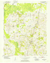
1951 · Brownsville
USGS Topo · 1:24,000
1951 · Sunnyhill
USGS Topo · 1:24,000
1952 · Stanton
USGS Topo · 1:24,000
1952 · Dancyville
USGS Topo · 1:24,000
1952 · Stanton
USGS Topo · 1:62,500

1956 · Blytheville
USGS Topo · 1:250,000

1959 · Blytheville
USGS Topo · 1:250,000
1959 · Hillville
USGS Topo · 1:24,000
1961 · Jones
USGS Topo · 1:24,000