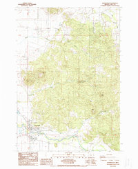
1988 Map of Brownsville
USGS Topo · Published 1988About this map
The Calapooia River winds through the southern portion of this Linn County landscape, serving as a focal point for the settlement of Brownsville. This 1980s-era survey documents the town's extent near the Brownsville Dam and the infrastructure supporting the local community, including the Sewage disposal ponds and a nearby Trailer Park. The terrain is characterized by a series of prominent rises such as Washburn Butte, Lone Pine Butte, and Cochran Butte, which punctuate the valley floor. To the north, Rock Hill stands near the headwaters of Butte Creek. Resource extraction and land use are visible through features like a Quarry near Snake Hill and a Cem located toward the northeast corner of the quadrangle. The map captures the transition from the structured town grid to the surrounding agricultural and timbered hillsides, providing a detailed look at the hydrology of Warren Creek and Cochran Creek as they descend toward the river valley.
Find a feature on this map
25 named features on this map. Tap any name to fly to it.
Don’t see what you’re looking for? This feature index may not catch every label — zoom into the map to look around manually.
Map Details
Editions of this 1988 Brownsville Map
This is the sole edition of this map. No revisions or reprints were ever made.
Other maps of this area

1909 · Rowland
USGS Topo · 1:31,680

1911 · Brownsville
USGS Topo · 1:31,680

1911 · Lebanon
USGS Topo · 1:31,680

1911 · Tangent
USGS Topo · 1:31,680

1912 · Halsey
USGS Topo · 1:62,500

1916 · Albany
USGS Topo · 1:62,500

1921 · Brownsville
USGS Topo · 1:62,500

1921 · Lebanon
USGS Topo · 1:62,500

1922 · Lebanon
USGS Topo · 1:48,000

1924 · Lebanon
USGS Topo · 1:62,500