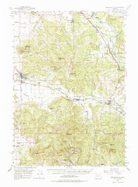
1950 Map of Brownsville
USGS Topo · Published 1985About this map
The Calapooia River winds through this mid-century landscape, anchoring the town of Brownsville and smaller communities like Crawfordsville and Holley. The map reflects a rural economy shaped by both river and rail, with the Oregon Electric and Sou Pac lines traversing the valley floor. Educational and spiritual centers of the time are well-documented, from the Courtney Creek School to the Berlin Union Ch, providing essential reference points for those tracing local family lineage.
Find a feature on this map
60 named features on this map. Tap any name to fly to it.
Don’t see what you’re looking for? This feature index may not catch every label — zoom into the map to look around manually.
Map Details
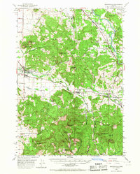
Editions of this 1950 Brownsville Map
3 editions found

Other maps of this area

1909 · Rowland
USGS Topo · 1:31,680

1910 · Eugene
USGS Topo · 1:62,500

1911 · Brownsville
USGS Topo · 1:31,680

1911 · Lebanon
USGS Topo · 1:31,680

1911 · Tangent
USGS Topo · 1:31,680

1912 · Halsey
USGS Topo · 1:62,500

1916 · Albany
USGS Topo · 1:62,500

1921 · Brownsville
USGS Topo · 1:62,500

1921 · Lebanon
USGS Topo · 1:62,500

1922 · Lebanon
USGS Topo · 1:48,000